| Original event date | 27th Feb 2016 |
|---|---|
| Duration | 6 hours |
| GPS Tolerance | 25m |
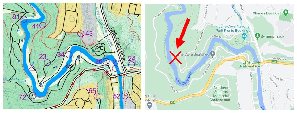
| Changes from the original event: | Features around some controls have changed due to vegetation growth etc. Take note of the Control Descriptions. |
| Start Location | You can Start at any control. If you do, you must finish at the same control to record results. The control you started at (including S1/F1) will be converted to start/finish by the MapRunF software, and you would not be awarded any points. The original HH site, marked S1/F1, will be changed to a virtual control (unless you start from there). In this event the software will award it 100 points :-))) |
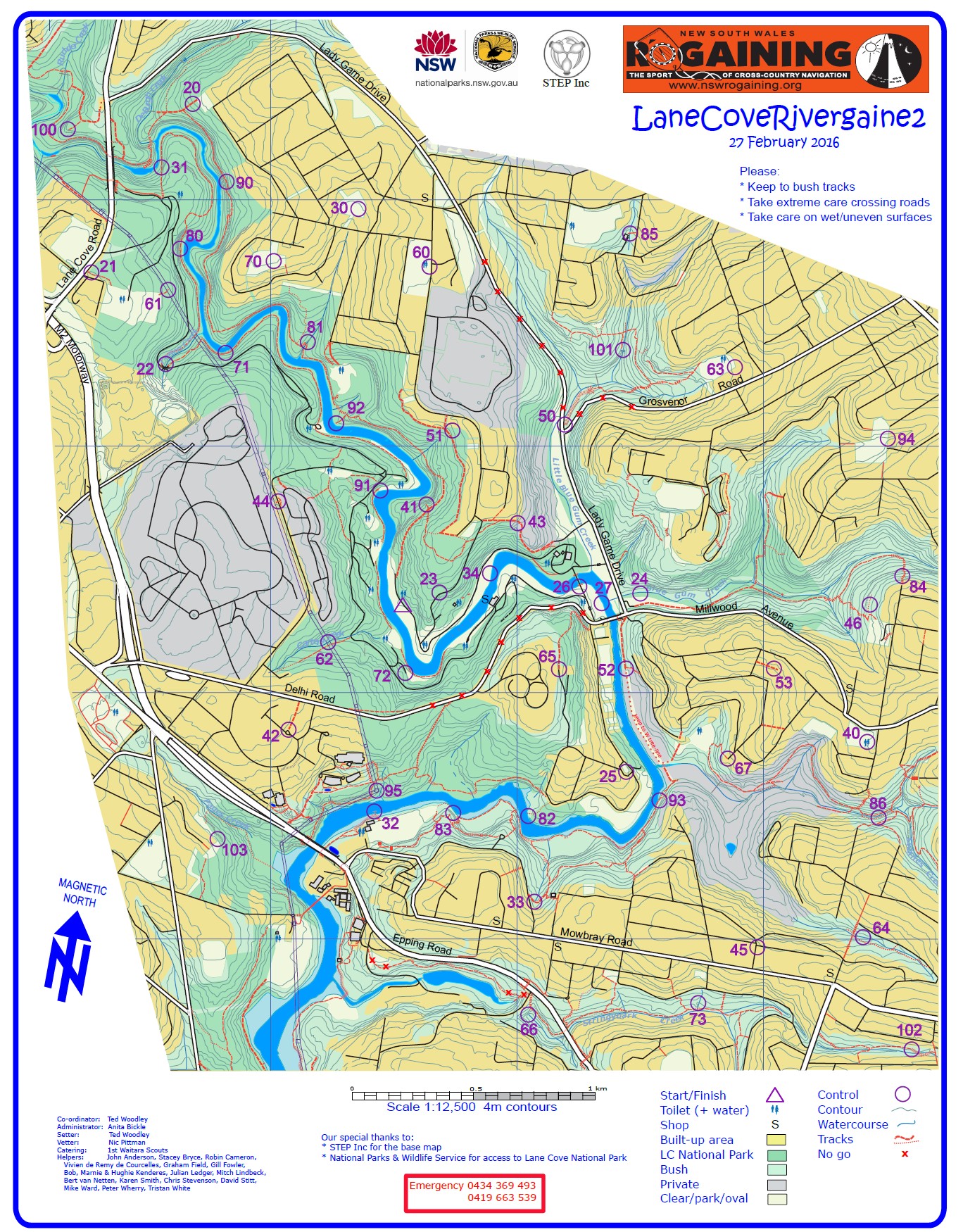
| Parking | Good parking areas include playing fields near controls 32, 85, 61 (NP), and 27 (NP). There are also smaller parking areas within the National Park (NP) along the river (identified by the toilet symbol in the clear areas). Note that entry into the NP incurs an entry fee of $8 per vehicle per day. |
| Links | Google Maps Link to HH Map and Event Files Original Event |
| Acknowledgements | Thanks to Colin and Colleen Mock for re-vetting this course and putting this MapRun event together. |