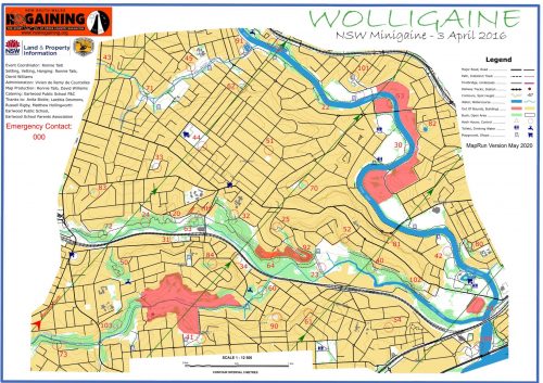
MapRunF - Wolligaine
| Original event date | 3rd Apr 2016 |
|---|---|
| Duration | 3 hours |
| GPS Punch Tolerance | 15m |
| Changes from the original event |
|
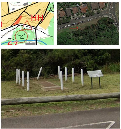
| Start Location | The Start/Finish for the Wolligaine map has been moved from the Earlwood Public School grounds to the southern side of Bray Ave, opposite No. 7. The feature is a sign in front of some poles around a mysterious artifact. |
| Links | Google Maps Link to HH Map and Event Files Original Event |

