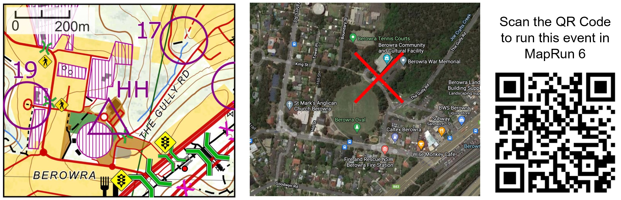
MapRun - Berowra Bewilderness

Original event date 25th Nov 2018
Duration 8 hours
GPS Tolerance 25m
Changes from the original event: • None
Start Location The Start/Finish for the event is located at the Berowra Community Centre, the Gully Rd Berowra, 200m from Berowra Station and just off the Pacific Highway and near the turnoff to the M1 Motorway.
You must start at the HH – “Start at any Control” is not available for this event.
Links Google Maps Link to HH
Map and Event Files
Original Event
MapRun6 Link Select here to go to this event in MapRun6 or scan the QR code below.
The HH is located at the central lawn of the at the Baden-Powell Scout Centre, Pomona Street Pennant Hills.