| Original event date |
28th Feb 2015 |
| Duration |
6 or 12 hours |
| GPS Tolerance |
25m |
| Changes from the original event: |
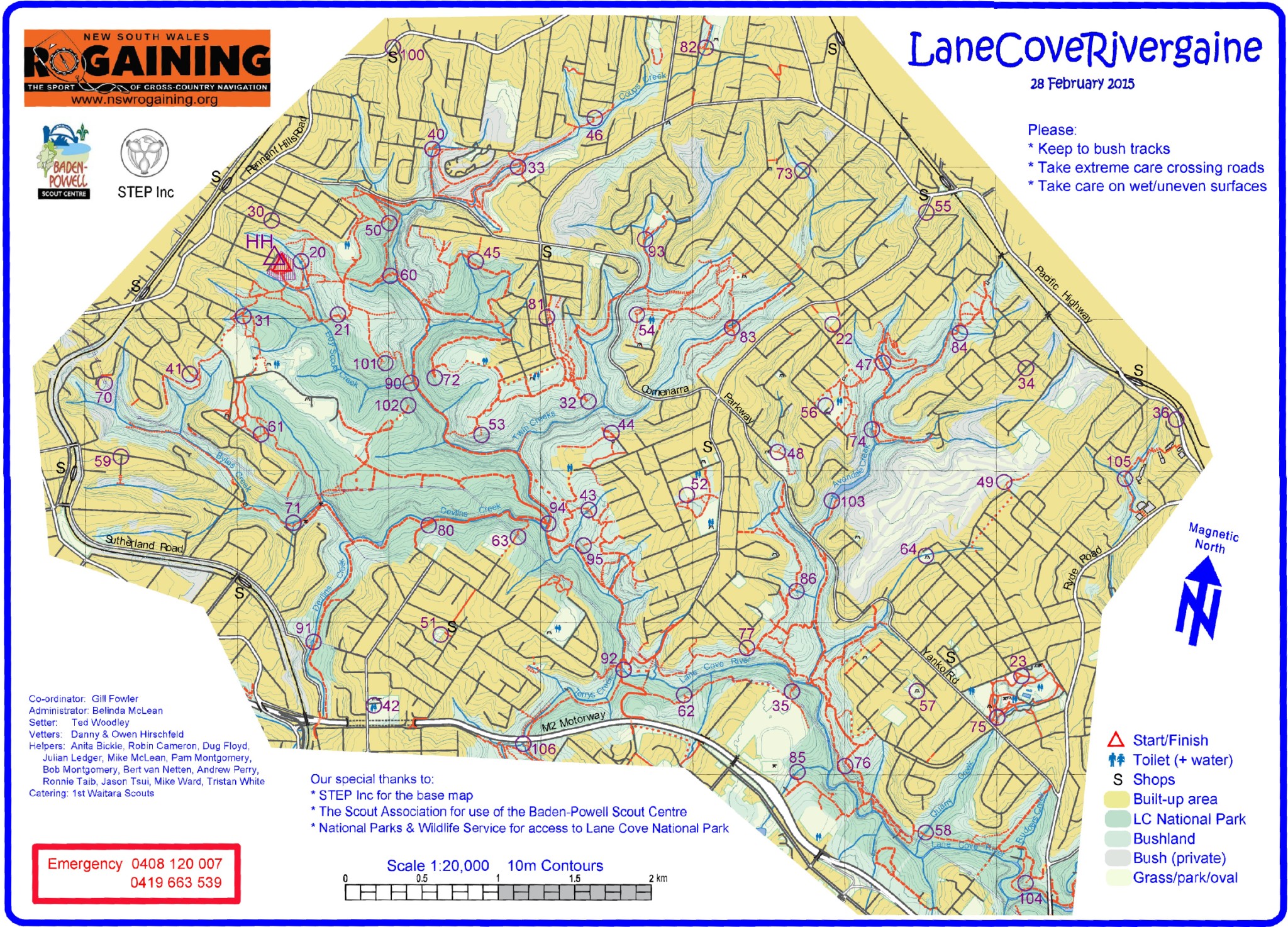
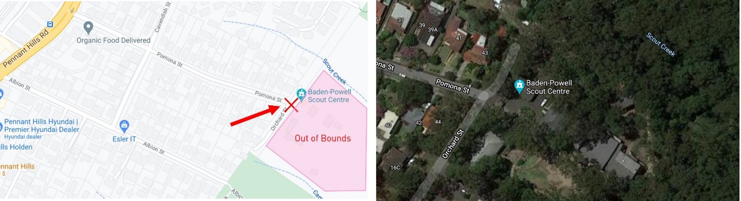
• HH location moved onto the road |
| Updates: |
• 06/08/2021 – Updated position of Control 102. The track on the map is out of position. Please reload the map on your phone to get the update. Thanks to Chris Stevenson for this.
• 10/05/2023 – 12hr event added to MapRun
|
| Start Location |
You can Start and Finish at any control. The original HH was at the Baden-Powell Scout Centre, Pomona Street Pennant Hills. It has now been moved to the front gate on the road as the Scout Centre is private property and Out of Bounds. A good alternate place to begin is at Pennant Hills Park where there’s easy parking and amenities. You can hit Control 31 to start. |
| Links |
Google Maps Link to HH
Map and Event Files
Original Event |