THE EXPLORERGAINE
Date
Sunday 29 March 2026
Location
Mt Victoria
Duration
6 hours
Status
Results available
Event overview
The Explorergaine is a 6-hour rogaine being held on Sunday 29 March at Mt Victoria on the western edge of the Blue Mountains. Whilst it is in the Metrogaine slot on the calendar this rogaine will be mostly on bush tracks. The event has a strong historical theme and is also a fundraiser for the Australian Himalayan Foundation.
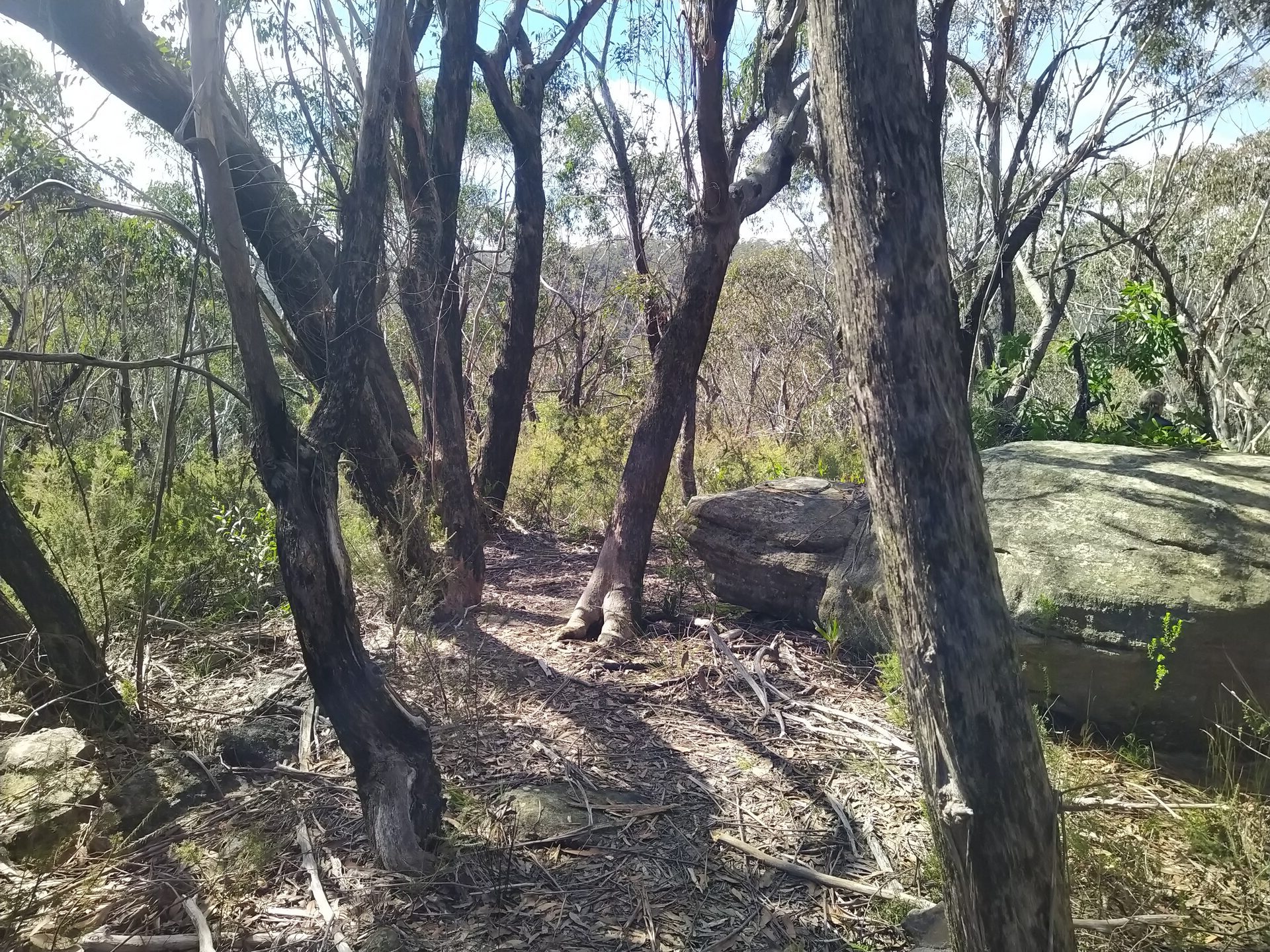
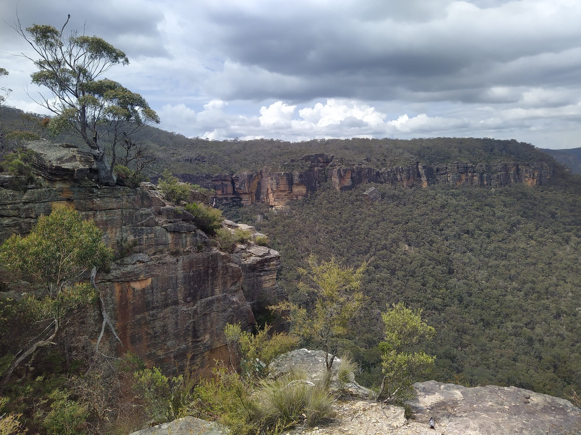
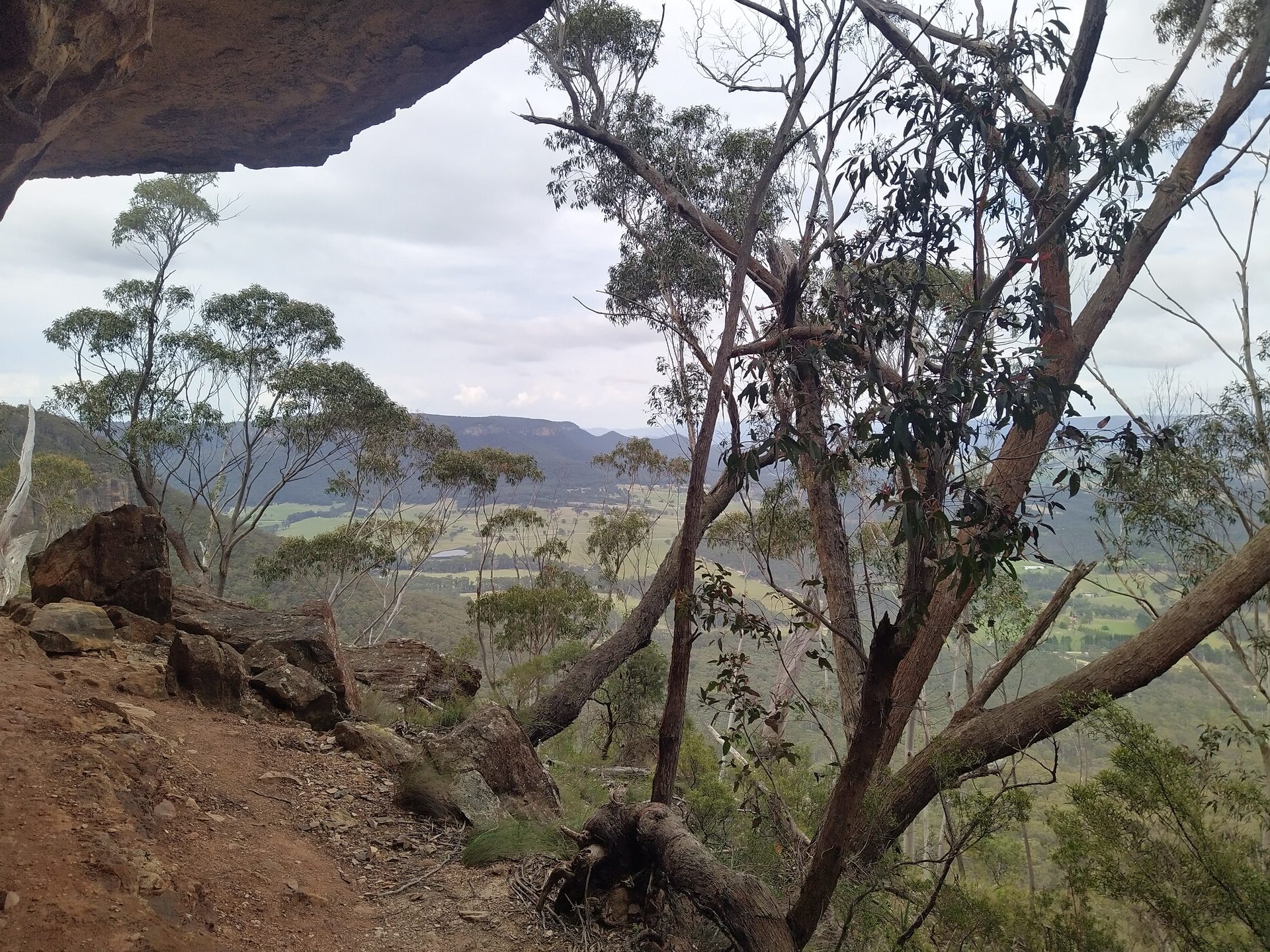
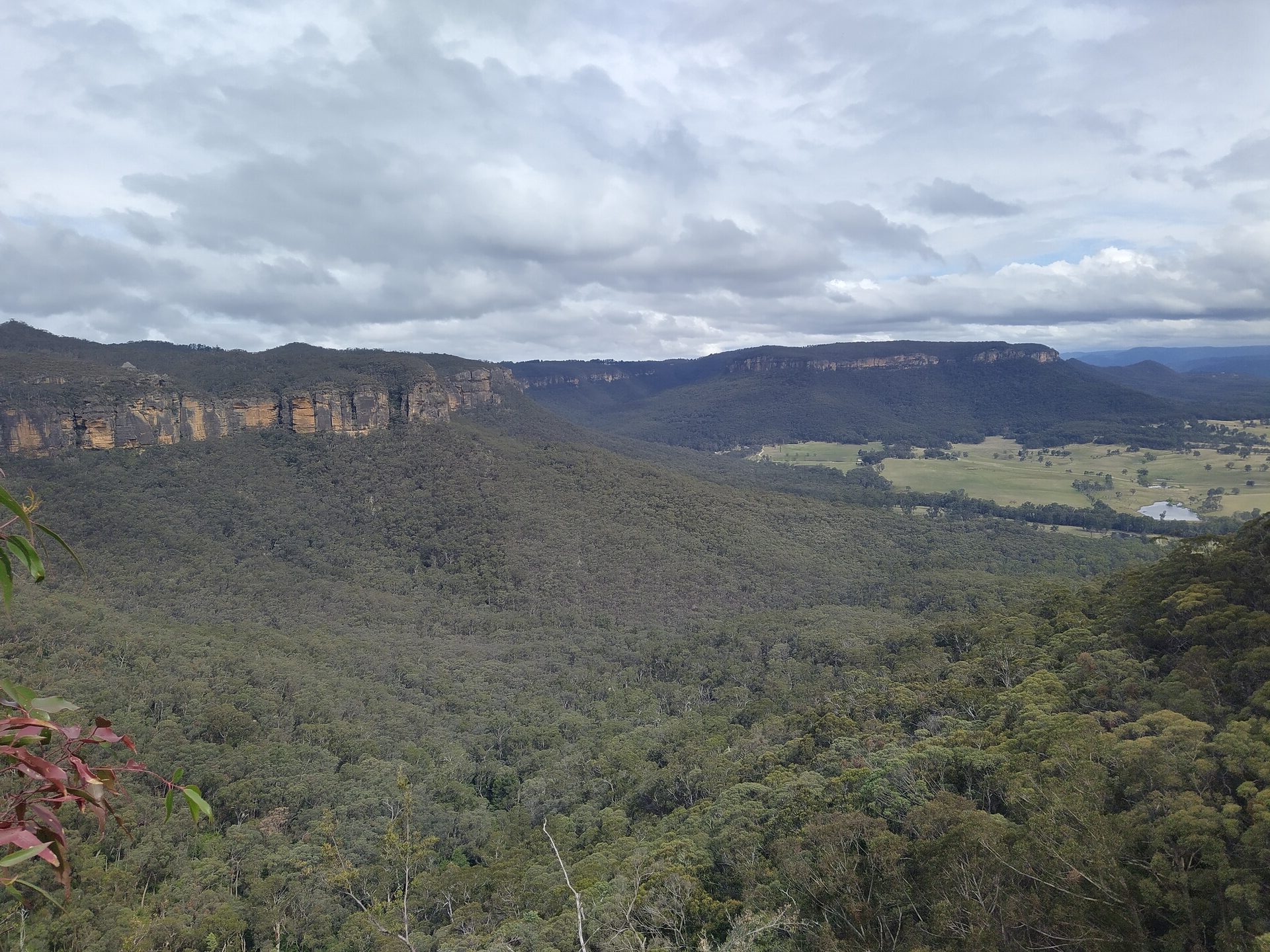
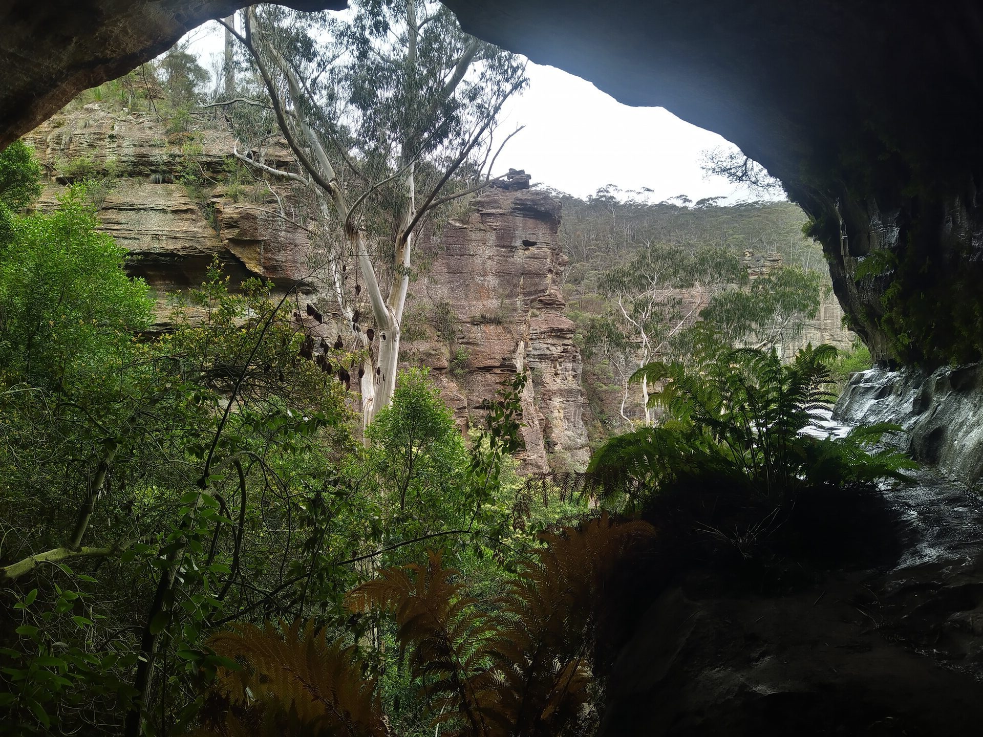
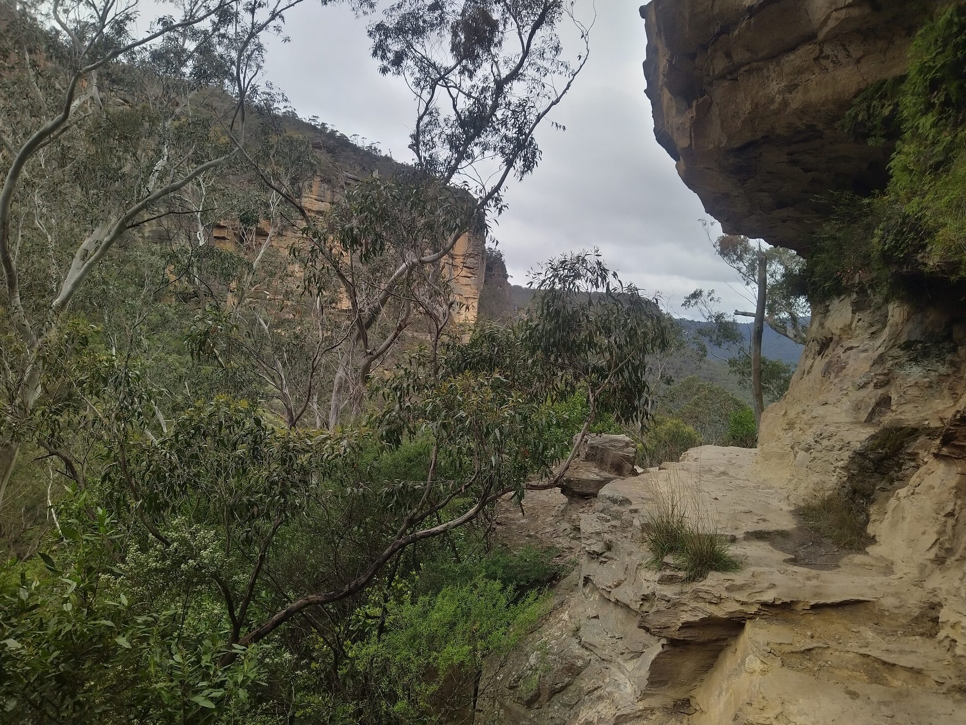
The course explores the first routes off the mountains dating back to 1813. There are outstanding views over the Megalong Valley, Hartley and across to the Great Divide. Expect a surprisingly complex choice of bush tracks both close to the Event HQ and for the fit and strong down to Hartley Vale. This event has something for everyone. The course setters are planning 50+ checkpoints.
Whether you’re a seasoned rogainer or a newcomer looking to explore a new area this is an event not to be missed.
This event promises:
✅ The first 6-hour event of the year.
✅ Scenic and challenging terrain.
✅ Community and camaraderie – meet fellow explorers.
✅ An excellent Event HQ at Mt Victoria Public School.
Entry fees and inclusions
- Up to 6 hours of rogaine exploring.
- Map and electronic timing (1 per person).
- Donation to the Australian Himalayan Foundation.
- Catering provided by the Mt Victoria Public School P&C.
- Sausage sizzle with vegetarian option.
- Watermelon, oranges and cordial.
- Cake, tea and coffee.
Course times
- 08:00: Registration opens and maps available.
- 10:00: Mass start.
- 16:00: Rogaine closes.
- Timings of novice briefing, final briefing and prize giving will be confirmed closer to the event date.
Location
- Driving from Sydney: Approximately 1.45 hours – Great Western Highway main route, Bells Road the option.
- Driving from Canberra: Approximately 3.30 hours.
Carpooling encouraged to save on petrol and limit effect of parking on local community. Parking in local streets and the Memorial Park car park.
Train
New Mariyung trains service this line. Times subject to confirmation, though no track works are schedule as of 27th Jan. Sit in the 2nd last carriage.
- 06:24 Depart Central Station platform 6 with stops at Strathfield, Parramatta, Blacktown, Penrith before all Blue Mountains stops. Arrives Mt Victoria 08:48 with short walk to the Event HQ.
Event map will be available on the website by 08:00 - Return 17:18 Depart Mt Victoria. Arrives Central 19:41
Rogainer Graeme Hill will be on board the 2nd last carriage to hand out maps from 8.00am (near Woodford). At Mt Victoria there is a 10-minute walk to the school. Cross Station St (now busy due the highway detour) at the traffic lights and use the northerly school gate off Great Western Highway. So that Graeme has sufficient maps to hand out, teams that are intending to take the train must text event organiser Julian Ledger on 0409 454 396 not later than 4pm on Wed 25th with their team number and the station they will be joining the train.
Accommodation & facilities
Event HQ
- The Event HQ is at the Mt Victoria Public school which is an excellent venue and has all facilities.
- Additional school gates will be opened to provide access from different streets.
Nearby accommodation
Make a weekend of it and stay over. There are heaps to see and do in the mountains on the Saturday
- Mix of accom available in Blue Mountains towns and Lithgow including holiday lets and motels
- Blue Mountains YHA, 207 Katoomba St, Katoomba
- Blackheath Tourist Park – cabins, glamping and camping
- Blue Mountains free campsites at Mt York, Hartley Vale and Megalong Valley – byo water, drop toilets. Limited camping spots.
Safety considerations
- Usual mandatory equipment of a whistle, space blanket and compression bandage apply.
- Keep clear of cliffs, no scrambling required.
- Usual wildlife hazards (e.g. snakes).
- Take care crossing public roads
- Event organisers will have a first aid-qualified volunteer on site.
- There will be a dual start/finish option on either side of the Great Western Highway removing the need to cross this major road in a crowd.
History
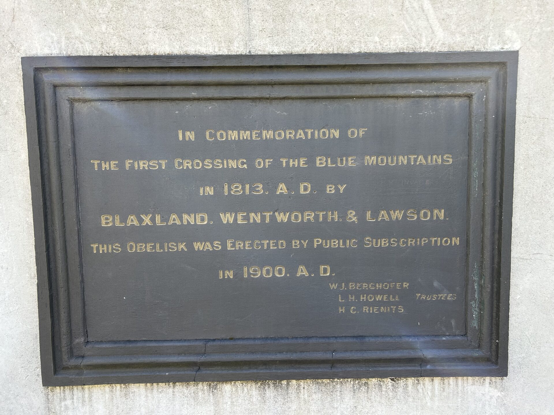
COXS ROAD – one of five routes off the Blue Mountains
The first crossing of the Blue Mountains by colonial explorers, on the traditional lands of the Dharug, Gundungurra and Wiradjuri peoples, was in 1813 by Blaxland, Wentworth and Lawson.
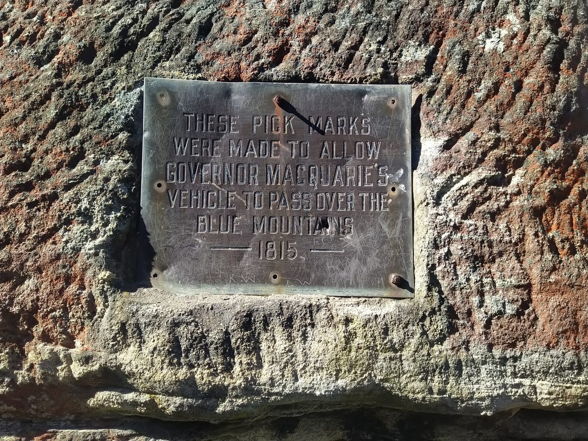
In 1814 the chief magistrate at Windsor, William Cox, was commissioned to build a road across the Blue Mountains. Starting on 18 July 1814 at Emu Ford on the Nepean River with 30 convicts he built a road (a bush track) to Bathurst through the rugged mountainous country in just six months.
The Coxs Road varied little from the current alignment of the Great Western Highway except for the descent to the valley from the mountain escarpment at the end of a spur projecting westward from the main Blue Mountains ridge at Mount York.
The construction of the pass at Mount York was difficult and in part the road had grades of 1 in 4 so Cox decided to make the road suitable for only a horse drawn cart with a light load.
The construction work over a five-week period in late 1814 has left substantial physical remnants of the old Cox’s Road including cuttings, gutters, retaining walls, fence sockets, and two bridge sites.
In about 1822 a new route from the Mount York spur was found by Lieutenant William Lawson and a track with a better grade (Lawsons Long Alley) was made to join the old road at the foot of Mount York.
By 1829 a further road between the first two roads was under construction by Major Edmund Lockyer (Lockyers Road).
In late 1829 the Surveyor-General Major Mitchell found a better route on a ridge parallel to Mount York at Victoria Pass. Work on Lockyers Road was abandoned and the work gangs transferred to Victoria Pass.
Early motor cars found the road too steep and a winding, but a less steep alternative known as Berghofers Pass was constructed between 1907 and 1912 to bypass the upper section of the Victoria Pass road. As cars became more powerful and reliable, the Victoria Pass road was improved in 1920 and became the principal road. Berghofers Pass was closed in 1934.
By John Anderson
Australian Himalayan Foundation
This event is also a fundraiser for the Australian Himalayan Foundation (AHF). It is an independent, nonprofit organisation with DFAT accreditation that works to improve quality of life in remote areas in Nepal, Bhutan and Ladakh. Founded by Australian trekkers and mountaineers inspired by Sir Edmund Hillary and the generosity of Himalayan communities, AHF partners with trusted local organisations to deliver long-term, community-led programs across education, healthcare and the environment. AHF has contributed $25 million over two decades to create sustainable, culturally relevant solutions that support vulnerable families and transform lives for generations. A portion of the rogaine entry fee (we hope $15) will be passed on to the charity.
In addition, during the month of March 2026, the Australian Himalayan Foundation will be running the AHF Trailblazer—their annual fundraising challenge. Trailblazers will walk or run the equivalent distance of the Everest Base Camp trek (130km) while raising vital funds for AHF’s programs in remote Himalayan communities.
It’s a great way to get active, support communities in need, and train for the Explorergaine. You can sign up at trailblazer.org.au.
The organising team
- Event organiser
- Julian Ledger
- Course setters
- Stephen Mckay and Bandit
- Course vetter
- Ian Brown
- Special guest
- Greg Mortimer
We would like to recruit a volunteer crew for the event including people who have trekked in the Himalaya – includes Event HQ support on the day or control hanging and collection. If would like to help please email julianledger@optusnet.com.au
Final instructions
Access final instructions here.The final details include further details on the location, event day, and much more.
For more general information on rogaining, you can check out the Learning Centre for advice on what gear to bring, what to expect at a bush event, and other information.
What is rogaining?
A fun team sport, navigating using map, compass and clues to visit as many checkpoints as possible within the time limit. It’s a “choose your own adventure” experience in outdoor environments where teams explore the course for as much or as little of the allocated time as they like.
Our sport is for all ages and fitness levels, from families walking with small children through to bushwalkers and runners. Rogaining encourages the development of strategy and navigational skills, fitness, and the ability to work in a team.
For more information, check out the Learning Centre.
![{"capture_mode":"AutoModule","faces":[]}](https://nswrogaining.org/wp-content/uploads/2026/01/IMG_20251202_134505_1-rotated.jpg)
![{"capture_mode":"AutoModule","faces":[]}](https://nswrogaining.org/wp-content/uploads/2026/01/IMG_20251125_112054_1-rotated.jpg)
![{"capture_mode":"AutoModule","faces":[]}](https://nswrogaining.org/wp-content/uploads/2026/01/IMG_20240908_115340_2-rotated.jpg)