NSW Rogaining Association
"Your Guide to Rogaining in NSW"
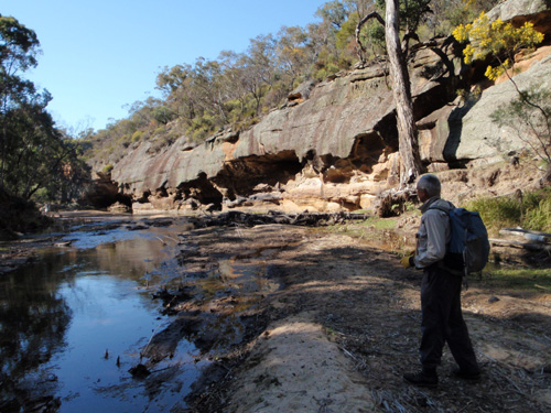
The Goulburn River, a trading highway for thousands of years but now only for rogainers
For many thousands of years the Goulburn River area has been a home and trading path for the aboriginals. The long sandy and flat rock river bed, is ideal for walking bare footed. The cliffs along each side honey combed with overhangs - ideal shelters. The river waters and nearby banks supplying abundant food and drink. A beautiful place with many things of interest and pleasure.
Bert enticed me up to help hang the flags with conversations like: "After that Dunns Swamp Navshield I knew that I had to set a course there at Dunns Swamp. But this one is an even better map, Dugy." Anita joined in "It is really beautiful, up there, with cliffs and sandstone caves along the river. Swallow nests up in the roof of the overhangs, Lyre Bird nests nestled in the little ledges. Some of the caves have rock which looks like honeycomb, beautiful. Wombats and kangaroos and wallabies all the time. Eagles flying through the sky, parrots, cockatoos, black cockatoos calling to you all the time. Lovely golden wattle everywhere you look and lots of other flowers." Bert. "Don't forget to say that all the side creeks leading into the main river, are little canyons, mostly easy to walk through."
I love it when the course setters are so enthusiastic, sounds like my kinda place. The flag hanging didn't let me down either, an ideal rogaining location. Nearly all of the course, open fast going for the right route choice, but tricky little controls if you pick another line in. The golden wattle seeming in full bloom when we arrived, just spread more each day to show there was more to come, of course late rock orchids, creepers, some purple, some white, add to the feast of colour. The native tree of the area is the pencil pine always friendly to see. I hope it is even better in two weekend's time.
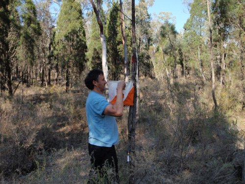
Bert at one of those tricky controls, when you approach from our direction
The sandy trading highway of the Goulburn River, for the ancient aboriginal inhabitants, is still there in good repair, to speed your way. But the incredible ever changing beauty takes your mind away from mundane things like trade, travel, routes, controls, or how to get out into that side creek. The overhangs that provided "hotels" accommodation for the aboriginal traveler, still there for us to see today, easily identified because the sand floor has become flat and level from the passage of so many feet over the ages.
Away from the rivers the land is open grass land or forest, gently undulating with the occasional outcrop of pagoda rock formations for even more interest. With a maximum elevation change of only 150m, not as tiring as some maps. There are some prickly scrub ridges in the very south of the course, but mild compared with other courses. I did manage to pick a bag of prickly pear fruit to make jam from (provided of course I can work out how to avoid the thorns).
Accommodation is good too, you have the options of a grassed area at the start, for camping or you can rent retreat cabins on the banks of the Goulburn River for the weekend.
On top of all else going for this location, I always love the drive there either from Sydney up through the Garden of Stones, Mudgee Ulan, or from Newcastle along the Golden Highway, through Sandy Hollow, Merriwa. These landscapes are spectacular at any time but specially now with rolling paddocks ablaze with flowering crop, set off by the blue sky that goes forever!
Thank you, Bernadette, Anita, Rob, Bert, a great outing. It is a pleasure to share this experience with you all. Till next time.
Dug Floyd September 2011.