NSW Rogaining Association
"Your Guide to Rogaining in NSW"
"Snakes and Ladders, Swings and Roundabouts"
Provisional Results
Forum
The forum provides a place for you to comment on this event.
Updates on Results
5 December 2011
Some scores have been corrected. There are still errors. The data required to publish the Team Sheets has not yet been provided by the administrator.
29 November 2011
The results are currently being revised and will be published here when the job is completed. The revised set will include "Team Sheets" so you can see with which controls you are being credited. You will also be able to get an idea of the route taken by other teams.
Apologies to the eight teams that are currently marked as being "Disqualified". In fact no teams should have been disqualified.
The Event Organisers have decided to grant concessions on four controls:
23. The question was “What are the colours of the slippery dip?”
There was no slippery dip! So those that questioned the control are automatically granted 20 points.
54. “What is the size of the rock platform? A - 10mx5m, B - 20mx10m, C - 50mx25m”.
The East West horizontal slab is around 60 metres though quite narrow at 5 metres. The central connecting slab is approximately 30 metres up the hill and is around 10 metres in width. 18 of 25 visitors correctly answered “C” but because of the “T” shape we will concede answer “B”. “A” is clearly incorrect.
62. “How many rows of seats around the fireplace behind the scout hall? A – 1, B - 2, C – 3”
The correct answer is “B”. There were 3 sets of seats each with 2 rows. This has caused a lot of confusion and resulted in 5 incorrect answers and 2 correct. We have therefore declared all answers as correct!
65. “How many man-made walls in the dam ruin at the Cascades downstream from the creek junction? A – 1, B – 2, C – 3”.
The correct answer was “B” as answered by 45 of 49 control
visitors. Three visitors being a little more particular noted that
one of the “substantial man-made objects” was actually two
intersecting walls. This brings the wall count to three, i.e. answer
“C”. We will accept this supplementary answer and stick to “man-made
objects” next time!
All other controls questioned by competitors were analysed and were
found to be answered correctly by a substantial majority.
Here is a complete Answer Sheet. (pdf)
Description
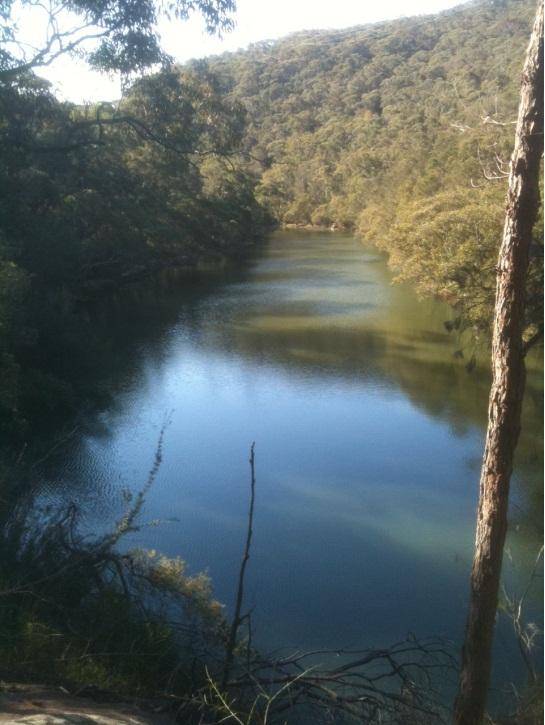
The social event of the year was held in the area bounded by Warringah Road (Roseville Bridge), Forest Way, Mona Vale Road and Arterial Road. The course was centred on the the leafy suburb of Davidson.
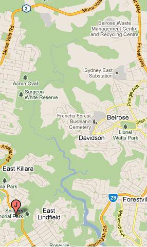
Participants were encouraged to select controls that were interlinked with the myriad of navigable tracks in the Garigal National Park. There were options for high routes with magnificent vistas and paths that followed the many lush creek lines and pretty waterfalls. Family teams had the option to explore the surrounding suburbs and visit the reserves and playgrounds that dot the area. The suburban streets provided a means of efficiently connecting parkland areas. The goal was to spread the teams far and wide and give everybody a chance to find their own way in relative solitude.
For general information about this event, contact ...
Neil Hawthorne
email:
socialgaine2011@gmail.com
phone: 0438 712 604
For entry or results related matters contact ...
Graeme Cooper
email:
admin@nswrogaining.org
Competition Categories
This event offered the normal age/gender based categories plus the 'Novice" and "Family" category. It also offered a "Legends" category in which all team members must be 65 years of age or over on the day of the event. See the " Competition Categories " page for more details.
Note that the "Under 23" category now replaces the Junior category at all NSWRA events.
